The Landscape of the Southeastern United States
This page is in its very beginning stages of construction and it mostly visual ramblings.
When I say "landscape" I mean the visual lay of the land and the things that are on it. This page is devoted to the more visually appealing places I've wandered to and through in the Southeastern United States. It's a place to go for what I hope are pretty pictures with a hint of natural history that will encourage folks to visit and explore the wonders of the southeast. Each place will have a Google map for directions. These pages serve more as a visual exploration of the southeast and will stay away from the complicated. For those, follow my links or head to my Flora of Georgia and surrounding states or Geology of Georgia and the Southeastern United States page for more information.
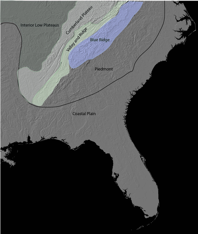
Our southeastern landforms were first classified in physiographic provinces by Nevin Fenneman* then refined over the years. The physiography of the southeast can be seen visually on this digital landform map which made drawing the regions in a simple task.
Look carefully and you can see the Coastal Plain, a physiographic province most think is just flat. The Fall Line is subtle, but visible where it separates the coastal plain from the Piedmont. The big landscape of the Appalachian Mountains, made up of the Blue Ridge, Valley and Ridge and its Great Valley of the Appalachians, the Cumberland Plateau and the Cumberland Mountain are all dicernable as each has a distinctive landform pattern. The interior plateaus are visible with the Highland Rim surrounding the Nashville Basin.
Within each province, there are a myriad of subtleties to be discovered. The drowned coastline of the Georgia Bight is obvious. Pine Mountain, Georgia's first mountain (at least coming in from the ocean) is obvious. The effect of the Brevard Fault creating a linearity on the landscape is obvious. Look beyond the river drainage's and mountain ranges and there is much to be revealed in our landscape.
*Fenneman, N.M. 1917. Physiographic Subdivision of the United States. Proceedings of the National Academy of Sciences of the United States of America 3 (1): 17–22.